When Kentucky’s Emergency Response Team (ERT) has to act quickly in response to chemical and oil spills in the Commonwealth, they rely on small, easily deployable buoys to collect critical data that help minimize and evaluate damages in environmental emergencies.
With a background in geology, Robert Blair primarily worked with groundwater and got involved sporadically with the ERT during groundwater contamination emergencies. Over time, this involvement led to him joining the ERT as an On-Scene Coordinator and then becoming the branch manager for the team and overall Emergency Response Branch.
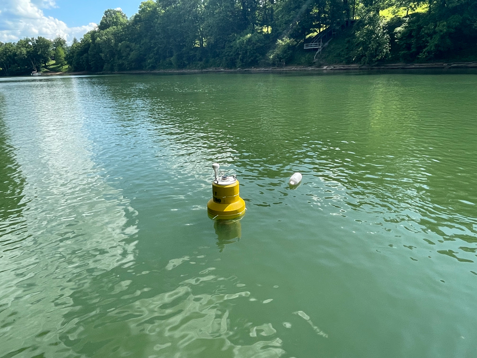
A NexSens buoy deployed on the Kentucky River during a recent training exercise conducted by Kentucky’s Emergency Response Team. (Credit: ERT)
Monitoring Solutions for Emergency Response
According to Blair, the goal of the ERT is to respond to confirmed and threatened releases of hazardous materials that can have a negative impact on the environment and public health. The ERT also assists the Kentucky Emergency Management team with large-scale incidents, such as severe weather, that can impact a significant portion of the population.
Since environmental emergencies can occur at any time and anywhere, durability, flexibility, and ease of deployment are at the forefront of emergency response solutions. In order to meet these demands, the NexSens small platform data buoy was chosen.
Each buoy is instrumented with a YSI EXO3 sonde to monitor temperature, pH, specific conductance, dissolved oxygen, and turbidity. The buoys are also fitted with a Turner C3 sonde for measuring petroleum products (crude oil and refined petroleum).
The buoys are equipped with a NexSens data logger, which allows the data to be viewed in real time on WQData LIVE.
“The ability to monitor water quality in real-time guides our actions and response to the hazardous material release. We can track the location of the contaminant of concern to determine the efficacy of mitigation activities and provide advanced warning to those who might be impacted,” states Blair.
He continues, “The primary example being the ability to advise a drinking water intake to shut down and allow contaminants to pass by without drawing them into their system. This remote sensing capability also provides ERT with a larger span of control while utilizing fewer staff and resources to assess impacts.”
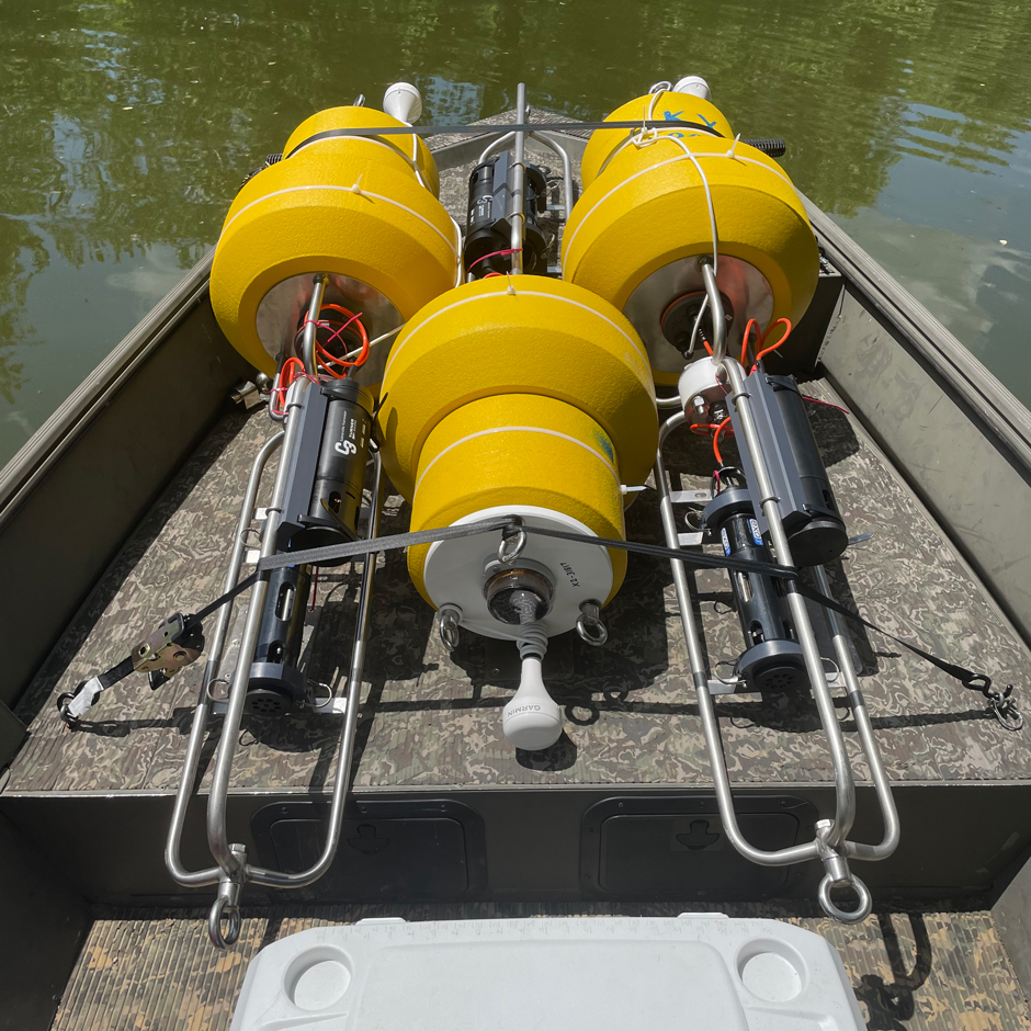

Buoys being transported on the Kentucky River during a recent training exercise conducted by Kentucky’s Emergency Response Team. (Credit: ERT)
The flexibility of the buoys and real-time data collection allows the team to monitor water quality over a large area and use fewer resources. The buoys also allow for hazardous materials to be tracked as they migrate after a contamination event. Such data make forecasting future events and impacts easier and helps create mitigation strategies.
Additionally, the buoys can help monitor improvements in water quality as time goes on, aiding the objective evaluation of emergency response strategies.
“One example would be using the buoys to monitor water quality downstream of a containment structure to determine its successfulness and ensure that no further contaminant migration is occurring,” explains Blair.
In addition to the buoys, the ERT performs grab sampling, though fortunately at a lesser frequency when used in tandem with the buoys. With fewer personnel having to perform manual sampling, more time is freed up for designing and implementing mitigation strategies.
Conclusion
While the buoys were originally purchased following a significant crude oil spill in the Kentucky River, they have yet to be deployed in response to an actual incident. Still, having the data buoys on hand and ready for deployment gives the ERT the tools they need to act quickly in an emergency. This promptness helps preserve and protect both the natural environment and public health.





Leave a Comment