Wesley Turner, an Environmental Scientist Advisor with the GIS and Data Analysis Section of the Watershed Management Branch in the Kentucky Division of Water, spends his days researching current technology and developing various drone programs for the Division of Water.
Having grown up during Love Canal and Valley of the Drums, Turner decided at a young age that he wanted to become a scientist and spend his life trying to right humanity’s wrongs and protect the environment.
“I loved looking at the plants and animals on the farm where I lived. I wondered at the beauty and mystery of the soil and water in the surrounding fields. As I grew older, I learned of the problems our species caused on the planet […] I remember thinking things had to change,” recalls Turner.
This childhood dream brought Turner to various resource management departments under the Commonwealth of Kentucky’s Natural Resources and Environmental Protection Cabinet.
Before his time with the Division of Water, Turner worked in various branches of Kentucky’s environmental departments, spending 11 years working for the Superfund Branch of the Kentucky Energy and Environment Cabinet. There, he managed some of the same National Priorities List sites he had seen on TV as a kid.
Today, Turner works to help improve water systems throughout the state, collecting data that are used for decision-making and have real impacts on human health and the environment.
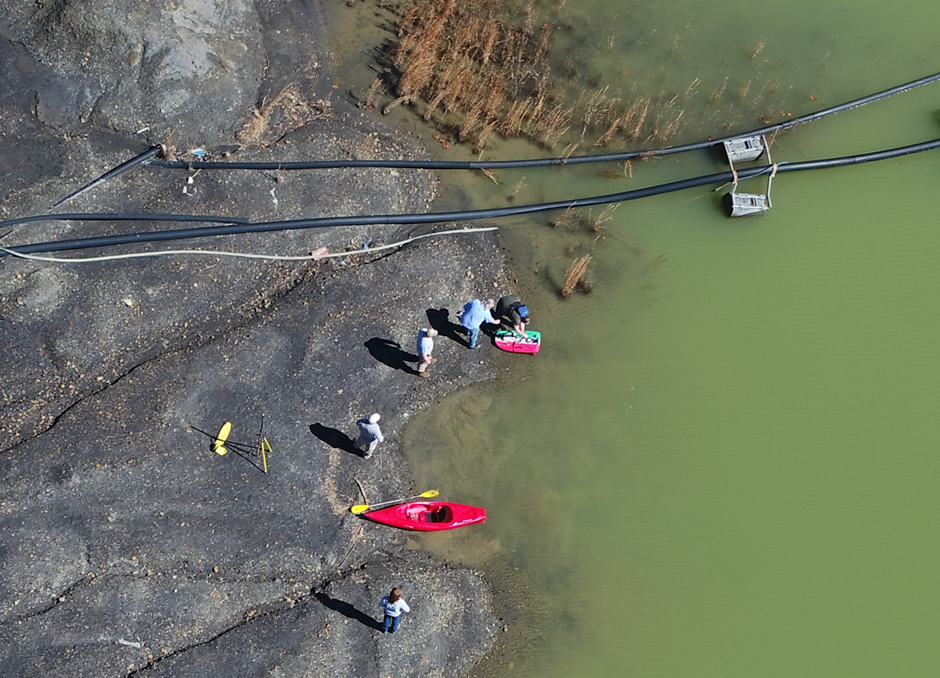
DOW bathymetry team assisting Abandoned Mine Lands in collecting depth /volume data at a coal pond retention basin. (Credit: DOW Drone Team)
Updating Existing Strategies with Drone Data and Manual Sampling
The mission of Kentucky’s Division of Water is to protect both the quality and quantity of water resources in the Commonwealth through various monitoring initiatives. These programs include bathymetric studies, water quality monitoring, and thermal drone surveying, which assist in evaluating the water supply and quality.
Over time, the Division’s monitoring programs have been updated to meet data demands in the region. For example, Turner and several colleagues across the Energy and Environment Cabinet worked to implement an Unmanned Aerial Vehicle (UAV) and Unmanned Surface Vehicles (USV) program in 2019, which helped make the environment more accessible for research.
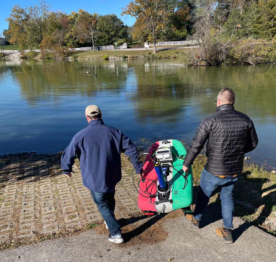

Josiah Frey and Ryan Parks deploy the rQPOD equipped with the EXO2 sonde and water quality probes. (Credit: DOW Drone Team)
One such program that got updated was the Division’s bathymetric monitoring, which began in late 2019 with the goal of measuring actual reservoir levels to determine the capacity of drinking water supplies. One of the main ways this measurement is done by using a remote-controlled boat (rQPOD) from YSI with a Sontek M9 Acoustic Doppler Current Profiler (ADCP).
The data collected from these studies are presented as a set of capacity curves so managers know the quantity of water available at any given elevation. While design records were previously relied on, the reservoir has changed over the years, and the bathymetric studies have helped to update strategies.
“We provide the data to help the water systems better understand what water they have available and prepare for drought conditions,” states Turner.
Over the years, the aerial drone program has grown substantially. This technology now includes the use of thermal sensors which should help to locate water line leaks and identify point and non-point source water inputs.
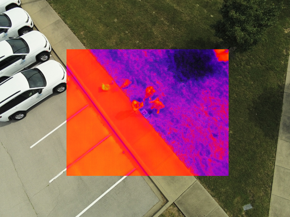

Thermal Image of the aerial drone team using the Aulel EVO II 640T dual camera drone. (Credit: DOW Drone Team)
A YSI EXO2-equipped USV targets monitoring parameters associated with harmful algal blooms and general water quality: conductivity/ temperature, turbidity, nitrate, total algae (chlorophyll & phycocyanin), optical DO, and pH.
The sonde can be mounted onto a remote-controlled boat, which can access areas where it is too difficult to take a larger sampling boat.
In addition to the use of UAVs and USVs, the Division of Water still conducts manual sampling using a SonTek CastAway-CTD in accessible areas of the reservoirs as well as hand held probes connected to the EXO2 Sonde using the YSI EXO Handheld Display.
“The data we collect and the methods we use to collect it are constantly improving. Ever-advancing technology means collecting more data for less cost while keeping those collecting the data safer while they do their job,” explains Turner.
He continues, “These technologies are expanding our ability to collect data in ways not possible 10 years ago. We can collect data in places that were too unsafe to attempt data collection, and we can collect quickly and at a density that was not imaginable just a short time ago.”
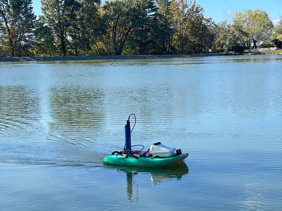

The rQpod equipped with EXO2 Sonde water quality probes collecting water quality data to monitor for harmful algal blooms. (Credit: DOW Drone Team)
Why Water Quality Monitoring is Essential
Human health is dependent on having access to clean water with an ample supply available, and while monitoring can help ensure the quality and quantity of water resources, such programs can be costly.
“Through the use of drone technology, large data sets can be collected and analyzed more efficiently, which results in lower overall costs. The teams can also deploy quickly, allowing for near real-time data collection,” states Turner.
He continues, “This helps us ensure everyone has safe drinking water and a sufficient supply of drinking water, while also supporting the recreational benefits of our waterbodies.”
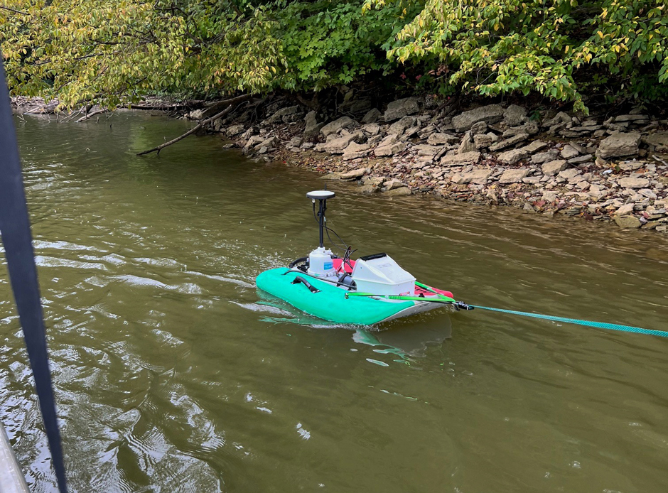

The rQPOD equipped with the Sontek ADCP being towed while conducting a bathymetric survey. (Credit: DOW Drone Team)
The implementation of such programs wouldn’t be possible without the continued collaboration of like-minded individuals.
Turner explains, “The most rewarding aspect of my job is getting to work with a wide variety of highly qualified professionals who are dedicated to preserving and improving the water and other resources of the Commonwealth. This dedication not only benefits all the Commonwealth’s citizens, but the whole country, since we are all connected in some manner.”
“I get a tremendous sense of pride when the data our programs collect are used to assist a struggling water system better understand their water supply, a group of concerned citizens trying to prevent harmful algal blooms in their lake, or a community trying to plan for better infrastructure such as dams,” he continues.
Turner’s dedication to updating monitoring strategies and innovation, like the use of drones and USVs, highlights the intersection of technology and environmental management. Staffed with exceptional and dedicated employees, Kentucky’s Division of Water is better equipped to achieve sustainable management as the programs evolve to meet data and environmental demands.
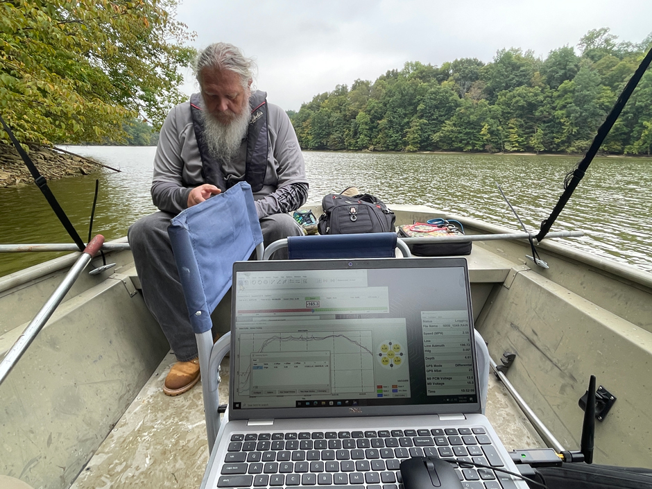

Wesley Turner monitoring the progress of the bathymetry mission using Xylem’s Hypack 2023 software. (Credit: DOW Drone Team)




Leave a Comment